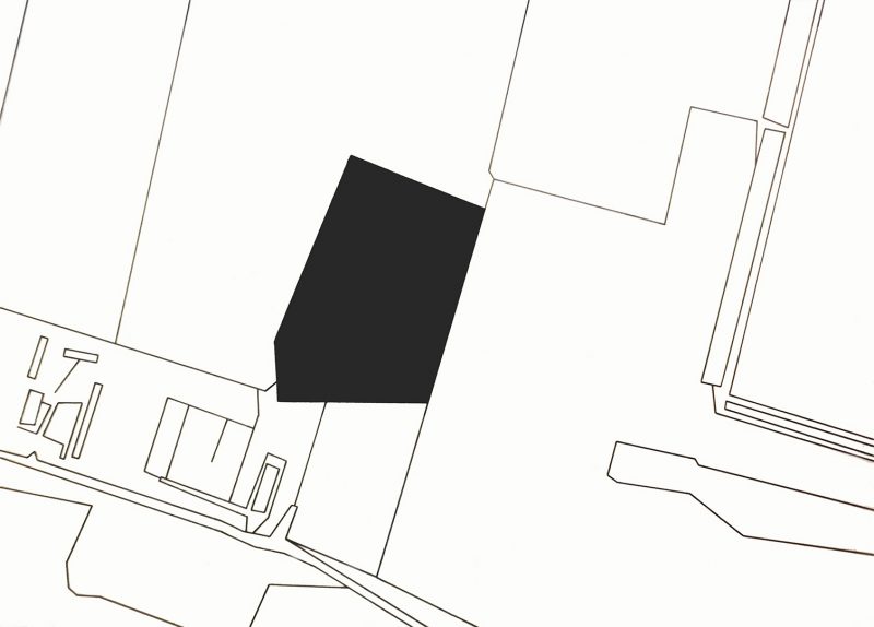
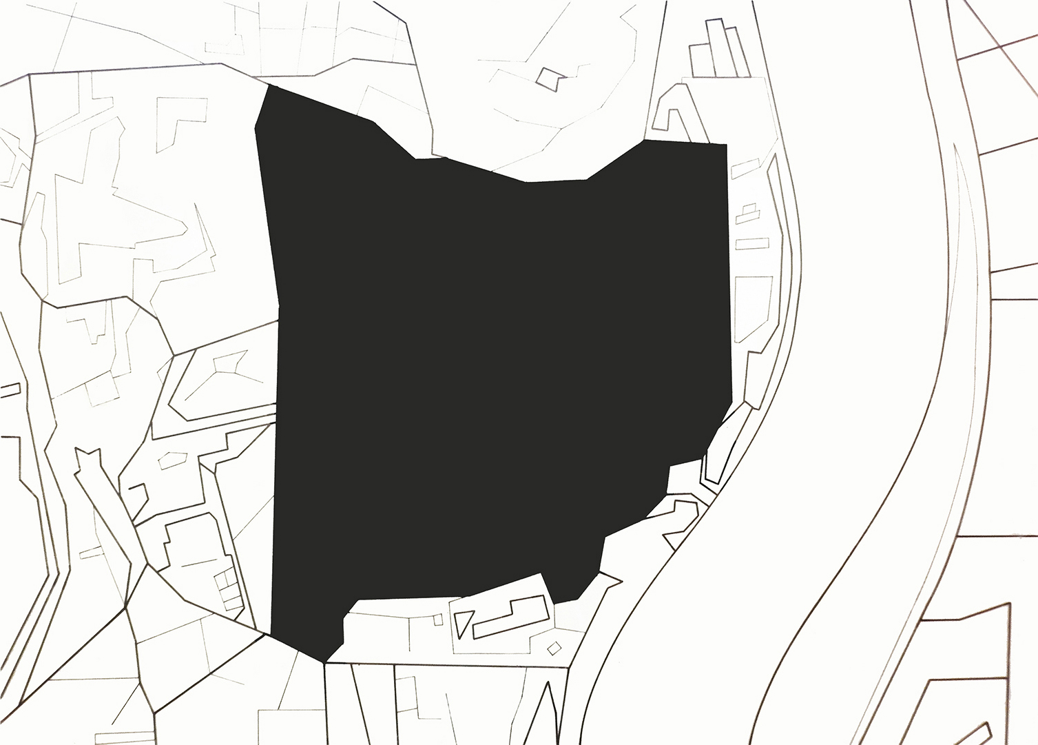
Pintura sintética y rotulador sobre acetato de vinilo / Synthetic paint and marker on vinyl acetate. 50x70 cm. (2014)
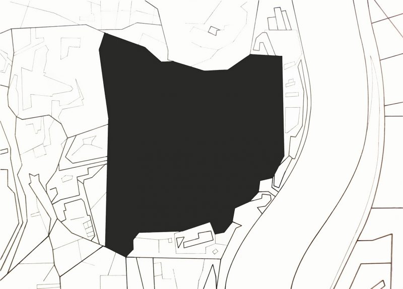
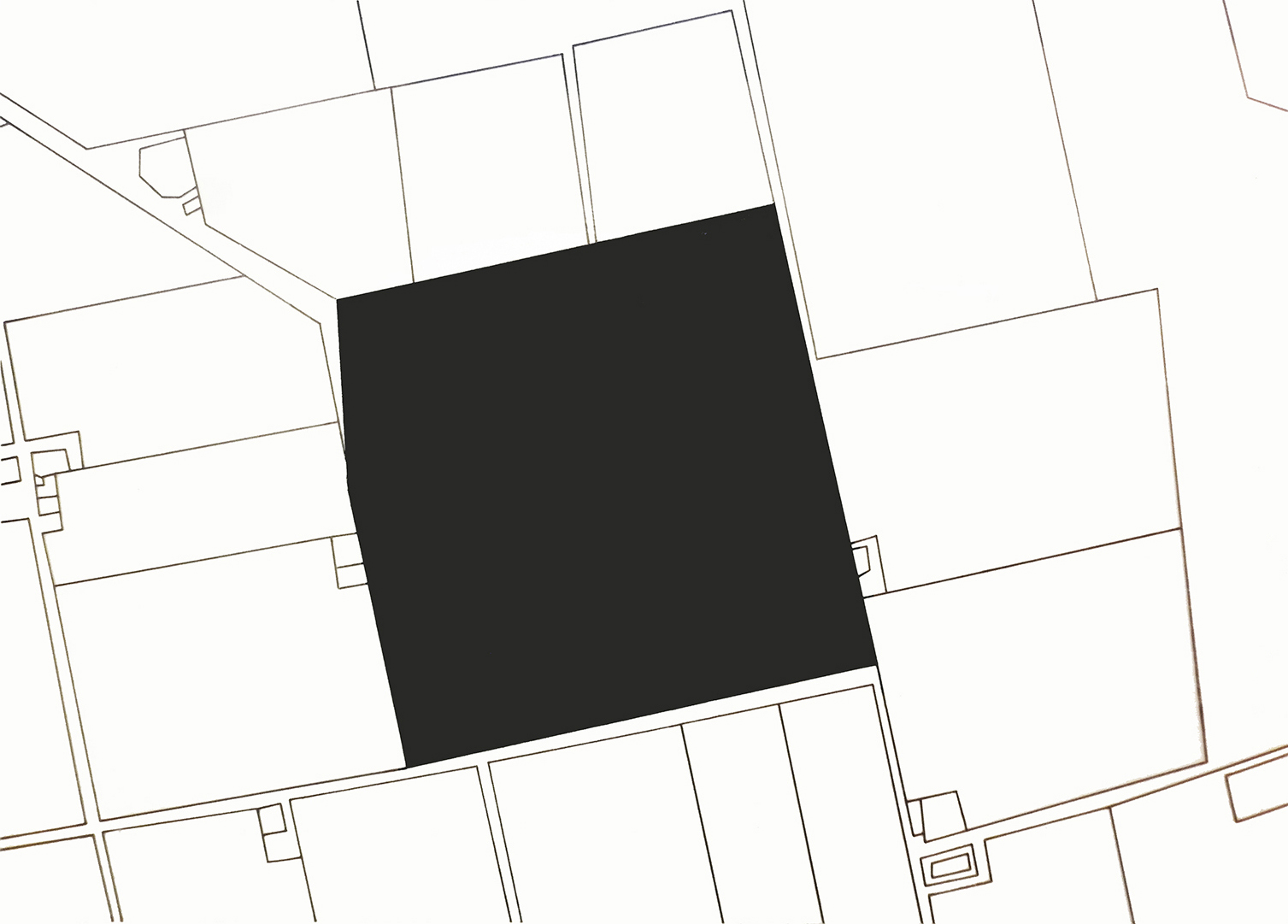
Pintura sintética y rotulador sobre acetato de vinilo / Synthetic paint and marker on vinyl acetate. 50x70 cm. (2014)
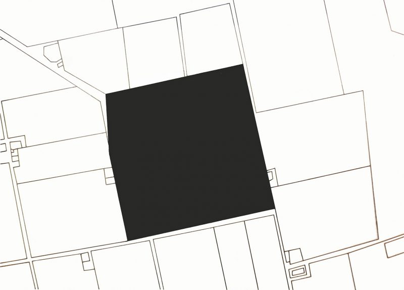
Pintura sintética y rotulador sobre acetato de vinilo / Synthetic paint and marker on vinyl acetate. 50x70 cm. (2014)
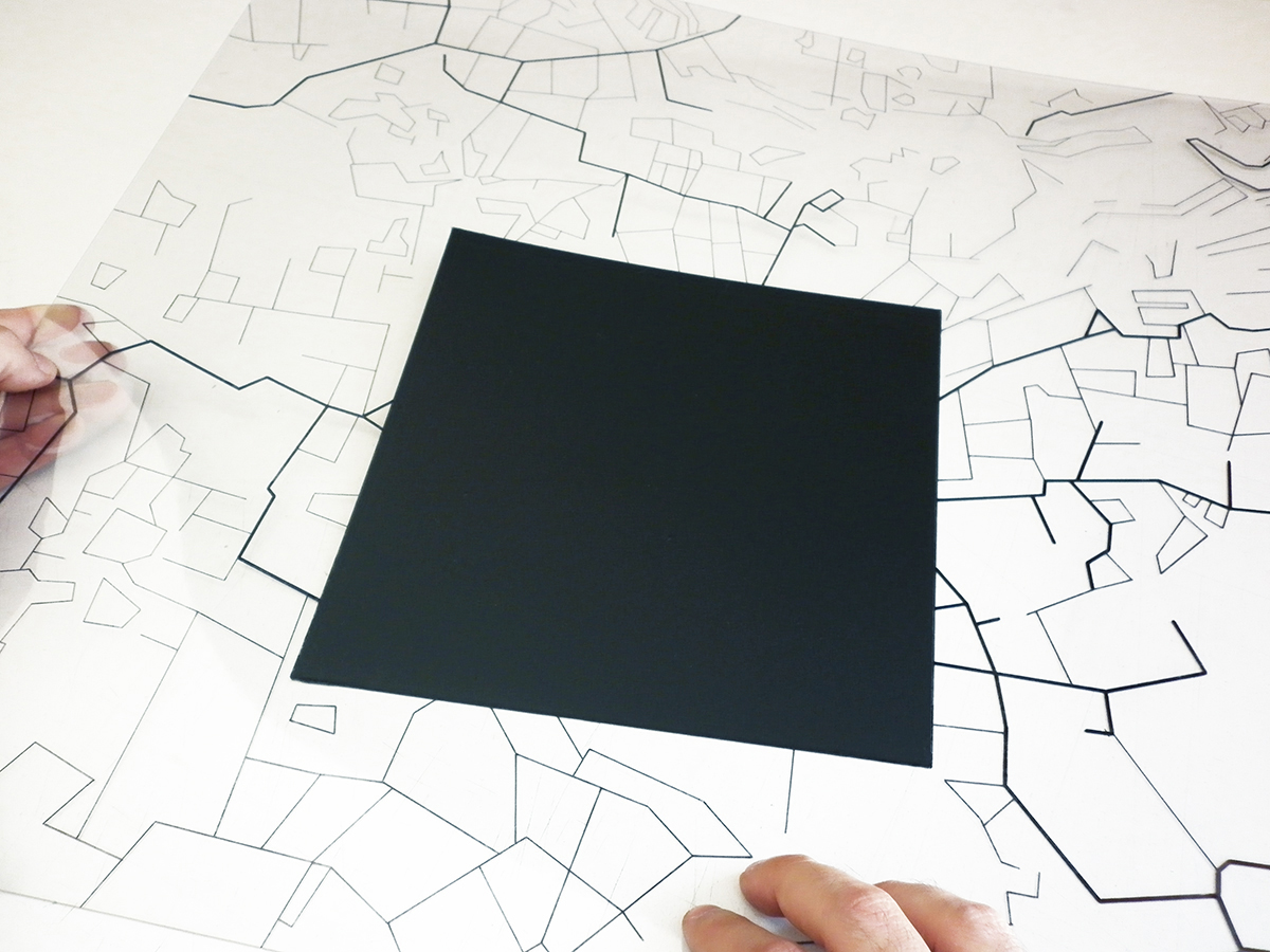
Pintura sintética y rotulador sobre acetato de vinilo / Synthetic paint and marker on vinyl acetate. 50x70 cm. (2014)
Pintura sintética y rotulador sobre acetato de vinilo / Synthetic paint and marker on vinyl acetate. 50x70 cm. (2014)
NOWHERE
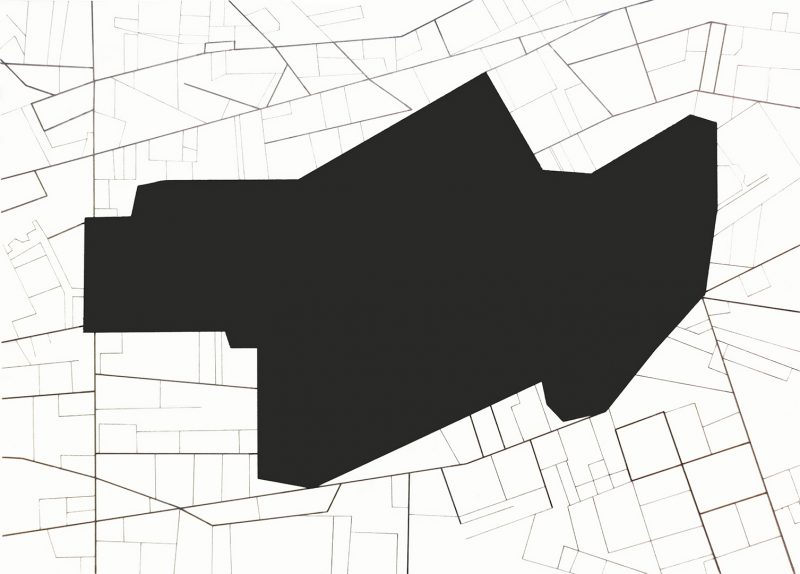
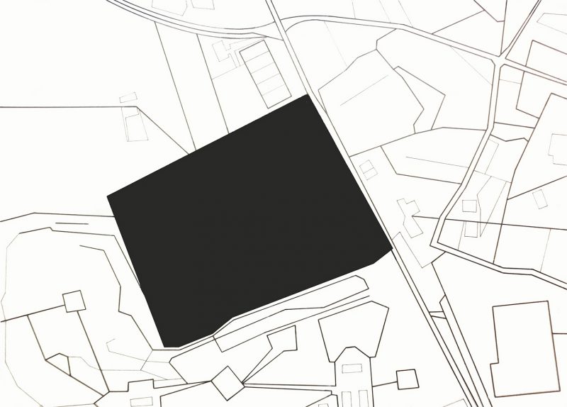
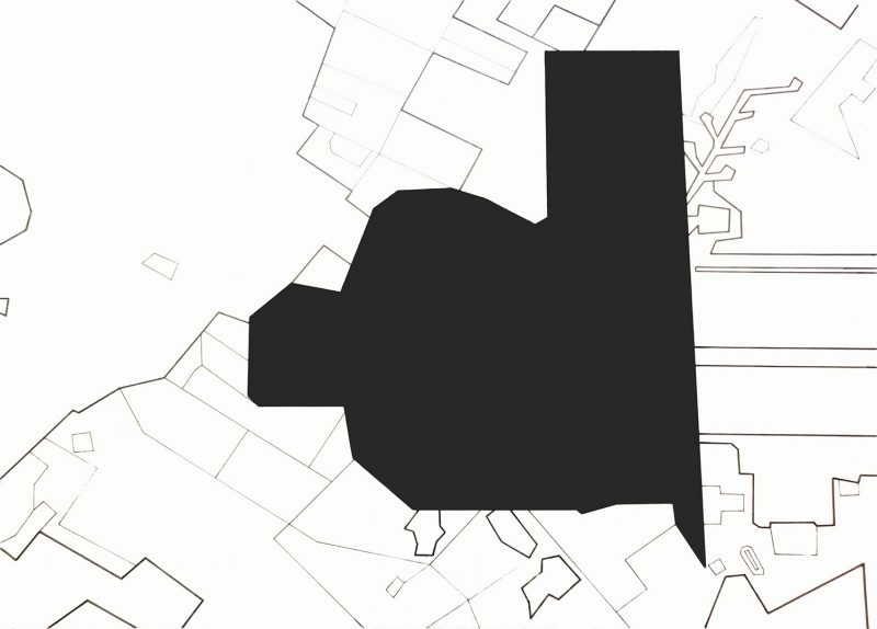
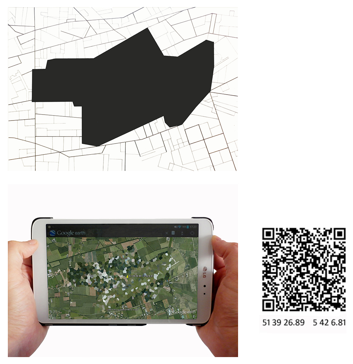
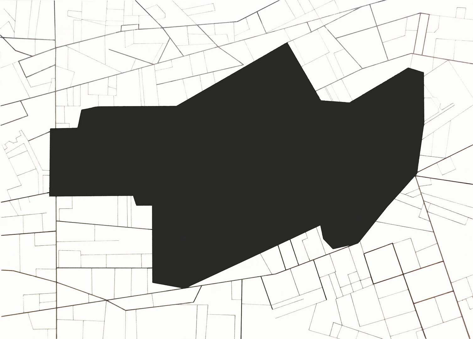
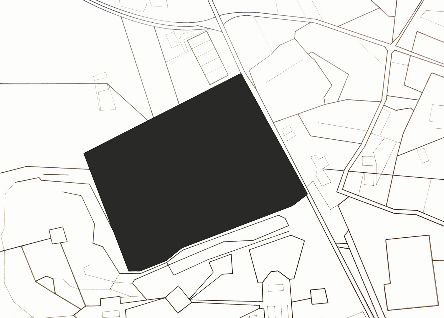
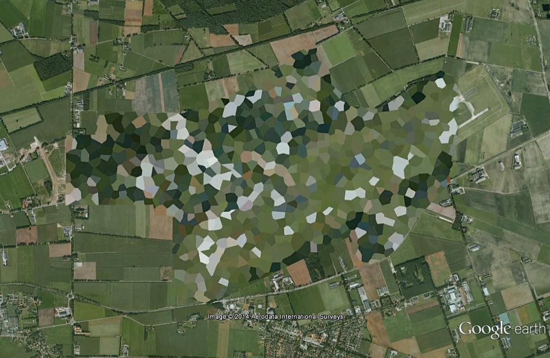
Hay lugares que no existen. El proyecto Nowhere nos muestra la censura existente en la cartografía por satélite, visible a través de las plataformas de información geográfica como Google Maps o el Instituto Geográfico Nacional (en el caso español). Este proyecto revela las tensiones existentes entre el derecho a la información de los individuos y las medidas que toman los Estados para “limitar los daños potenciales a la Seguridad Nacional”. De este modo se establece una relación entre el territorio, la sociedad y el Estado.
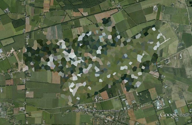
Estos lugares, paisajes o territorios se distorsionan, pixelan o difuminan con una clara intencionalidad. Deliberadamente se “borran” del mundo. El acceso a este tipo de información, supone para los Estados un riesgo. Nos encontramos con complejos militares, centrales nucleares, bases aéreas o lugares de los que desconocemos el uso de sus instalaciones.
El proyecto Nowhere rescata este tipo de información y la presenta a partir de un estudio del territorio que juega con la idea de lo que es visible y lo que está oculto. Por otro lado, invita al espectador a ser conocedor de estos espacios, dando las coordenadas exactas de los lugares “prohibidos”. El proyecto promueve una relación activa con el espectador, ya que permite que el público pueda acceder a estos lugares a través de sus smartphones (introduciendo las coordenadas de estos lugares en los buscadores de Google Maps o a través de un código QR).
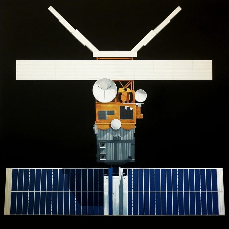
Por otro lado, se presenta la figura de un satélite de observación como elemento paradigmático. El satélite se muestra como una imagen descriptiva de la actualidad: la realidad de la información, la tecnología y la globalización. Pero también establece una relación totémica, donde el objeto, el satélite, se convierte en el espejo de la mitología actual.
----------------------------------------------------------------------------------------------------------
There are places that do not exist. The Nowhere project exposes the censorship that currently exists in modern satellite cartography; a reality that is evident when using geographic information platforms, such as Google Maps or the Spanish National Geographic Institute. The underlying foundation of this project is to expose the existing conflict of interests between the individual’s right to access information and the measures taken by the state to limit any “potential detriment to national security”, thus establishing a relationship between territory, society and the state.
Whether landscapes or territories, these places are distorted, pixelated or blurred with a clear intention; that of deliberately erasing them from the world. Access to this type of information poses a risk to the state. They concern military complexes, nuclear power plants, air bases or installations whose purpose of existence is completely unknown.
After rescuing this type of information, the Nowhere project presents it in the form of a study of territory, which explores the notion of the visible and the hidden. It is an invitation; an incitement to discovery, in which the spectator, who is provided with the exact coordinates of these “forbidden” places, is permitted access. This interactive aspect of the project creates an active relationship with the spectator, who by introducing the coordinates in Google Maps search engines or through QR codes may discover their existence.
As a paradigmatic element, an observation satellite is portrayed as a descriptive image of today’s world: the reality of information, technology and globalization. Similarly, it also serves to establish a totemic relationship, in which the object, the satellite, becomes the mirror of current mythology.
